")
Section length: 13 km
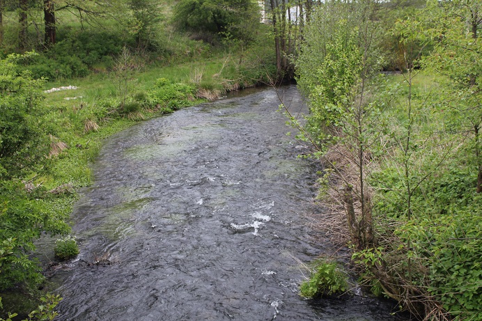
It is best to start your boating trip in Płocicz and finish in the village of Garbaty Most. The route is moderately difficult and onerous in places at low water levels. The source stretch, from the vicinity of the large Dymno Lake near Koczała village, is called Kuśnia (less frequently Kuźnia). After about 10 km, a two-kilometre long river called Ruda flows in on the right. Both rivers join their crystal clear streams at a quiet place called Dwa Mostki. From there on, the route follows the Ruda River. The Ruda River (with the Kuśnia) features a high variability of states, its water level fluctuates, and its riverbed width changes dynamically. Consequently, on larger backwaters and shallows you may occasionally have to drag your kayak.
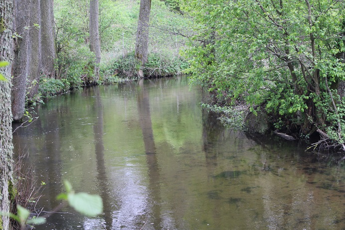
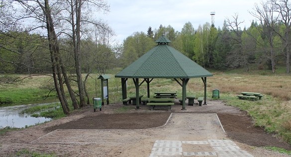
It is best to start your trip at the bridge in Płocicz at the kayak marina. Initially, the route may be slightly overgrown, with a too low water level; the river is narrow and mostly crosses less interesting agricultural areas. Downstream of Płocicz, the route enters forest land. This stretch is about 3-5 m wide or slightly more in places. The bank on the right is much gentler and almost completely covered with pine forest. The left bank rises higher and higher and is covered with mixed forest (oak trees). You reach a narrowing of the route with a rocky, increasingly shallow bottom. You go past a wooden bridge and ruins of a former “mill”. Then, the route enters the Dolina Kuśni valley – a charming place without any human civilisation. The river becomes wider and there are several islets (clumps) on it. It can be shallow in places and the river is overgrown here and there. The route reaches a wooden bridge and a wilderness. Downstream of the bridge, on the right, a stream flows in. The Ruda River begins. Further on, you go past another overgrown bridge. This is why the place is called Dwa Mostki (two bridges). The Ruda (and the Kuśnia) downstream of Dwa Mostki is a gentler river. It flows mainly across a wide, flat valley and several dozen meters on the left and right of it, up to the forest line, there are meadows and pastures. 5 km further, you reach the village of Suszka. In the distance, buildings of the wattle and daub structure can be seen. On the left, there is a kayak marina, and on the right, nature monuments, namely impressive oak trees. Straight ahead, there is a bridge and rapids. Downstream of the bridge, the river meanders quite dynamically: on the right, it directly borders large stretches of forest, on the left, it flows along a strip of meadows, closed off from the north by a forest. You reach Rudniki, located among forests and swamps, far from civilisation. After leaving the village, the “delta” section of the Ruda River begins, where it flows lazily between marshy reclaimed meadows. You also pass islands of rushes, small marshes, lakes, oxbow lakes and backwaters. The route reaches the Brda River. After leaving the mouth of the Ruda, you turn left, against the current. After about a kilometre paddling, you reach the Garbaty Most marina. Persistent ones can continue their trip down to Dolinka. This is about 6 km of paddling along the Brda current. On the way, there are gentle meanders, a valley with meadows and reeds and nature reserve Osiedle Kormoranów Pakotulsko (Pakotulsko Cormorant Settlement) or rather its remains after damage caused by cormorants that used to nest there.