


Section length: 19 km
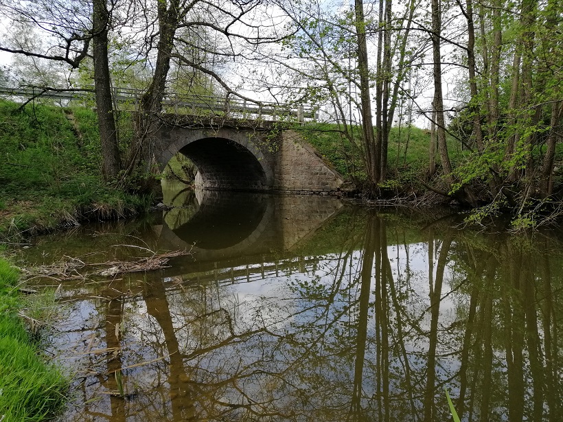
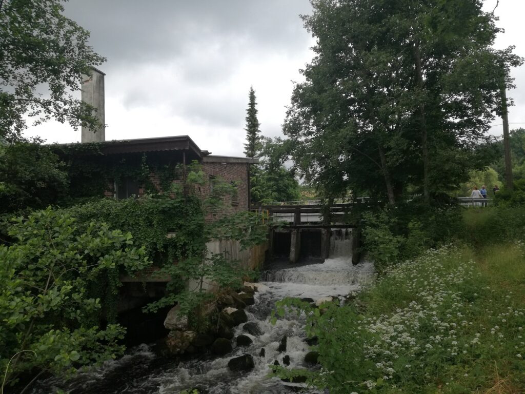
The Bukowina River guarantees eventful trips. It is best to get a single kayak as a substantial challenge awaits a kayaker here. The kayaking trip down the Bukowina River will definitely consume an entire day and it will be full of adventures. The numerous trees and obstacles in the current as well as rapids will not let you be bored for even a moment. This is a route for experienced kayakers. The Bukowina flows through forests and meadows near the villages of Bukowina, Siemirowice and Oskowo. In the Kozin village, it flows into Łupawa River. When paddling down the Bukowina River, you may set off from Kamienica Królewska near Sierakowice and then paddle through Lakes Kamienickie and Święte. However, it is more convenient to set off near the bridge on road 214 (Sierakowice -Bukowina). On the way, you pass a trout farm on the right. Along the peaceful current, you paddle to Siemirowice where the river accelerates with every meter of its course. You reach an old, broken water gate. You should be careful here. Along the way, there are several lodges and fallen trees. You reach Oskowo, with its stony rapids under the bridge. You pass a road bridge on the Bytów – Lębork road. Then you re-enter a forested area. The most interesting section of the river begins here. You pass the overgrown backwater in front of the ruins of a railway bridge. A large step in the bottom. This section is a rushing mountain stream. At the same time, it is narrow and winding. There are many obstacles and sometimes large logs lay across the riverbed. In the bottom, dangerous stones are hidden under the water surface. Right before Kozin, the river slows down and widens. When the water level is low, there can be shallows. Near a small hydroelectric power station, there is a portage. After launching you kayak, you paddle for 250 m to enter the Łupawa. In Kozin, there is a good spot for camping or finishing your trip. However, you need to arrange it with the owner of the land.