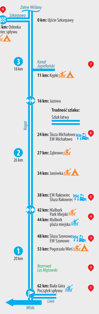

1.Biała Góra – Malbork (20 km)
2.Malbork – Jazowa (26 km)
3.Jazowa – Osłonka (18 km)
1. Biała Góra
2. Las Mątawski reserve
3. Szonowo barrage
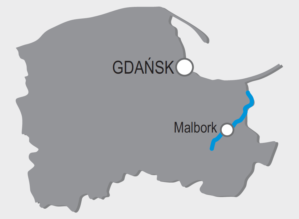
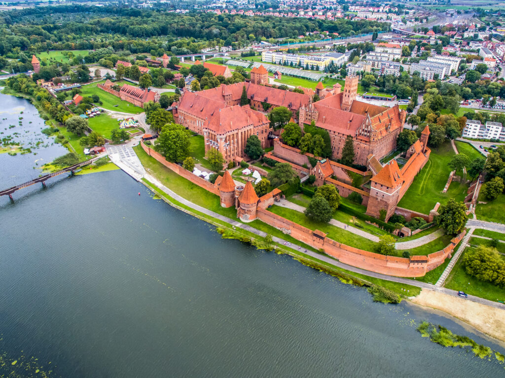
4. Malbork – city and castle
5. Rakowiec barrage
6. Michałowo barrage
7. Jagiellonian Canal
8. Osłonka
1. Biała Góra – Here it is possible to see a complex of hydrotechnical facilities constructed since the 16th century in order to separate the waters of Wisła and Nogat which until that time constituted Wisła’s main stream. It is worth to go up to the highest point of the facility from which a vast panorama of the Wisła Valley can be seen.
2. Las Mątawski reserve – A reserve protecting one of the last fragments of a natural and primal riparian forest at the Wisła Valley. The trees growing there – ash, oak, and alder – are often more than 150 years old and constitute shelter for many rare bird species, as well as an animal refuge. At the same time it is the largest forest complex in the entire Żuławy and a memoir of the impassable, watery woods, once covering the valleys of the rivers present there today.
3. Szonowo barrage – One of the three hydrotechnical constructions regulating the water level of Nogat. Erected in the years 1914-16, it possesses an original construction. It includes a lock and a contemporary water power plant.
4. Malbork – city and castle – Malbork is known primarily for its monumental Teutonic Order castle which towers over Nogat and looks especially astonishing precisely from a kayak. It is the largest brick construction in the world. Kayakers can moor by the shore of Nogat, directly under the castle, or earlier at an urban marina before the road bridge, as well as by the new Park Północny marina.
5. Rakowiec barrage – A complex of hydrotechnical constructions regulating the water level of Nogat, located below Malbork. It consists in a lock, dam, and weir constructed in the years 1914-16, as well as a water power plant from 1934.
6. Michałowo barrage – Next to the constructions in Szonowo and Rakowiec it is one of the three hydrotechnical constructions regulating the water level of Nogat. It has been constructed in the years 1912-15 and is operational today in an unchanged form. It is currently complemented only by a water power plant.
7. Jagiellonian Canal – It is a historical water trail constructed in the 15th century by the Teutonic Order in order to shorten the water distance from Gdańsk to Elbląg. It is almost 6 km long and connects the Elbląg River with Nogat.
8. Osłonka – Osłonka constitutes one of the most significant polder drainage device complexes in Żuławy. Without the operation of the pumps located there, with their efficiency at 21 thousand liters per second, the entire Żuławy area would be flooded. The noise coming from the complex means that the process of artificially pumping out the water flowing into the polders from neighboring rivers and canals which are located above them, is in operation.
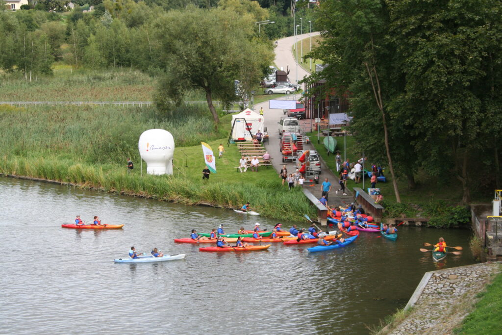
An original alternative for a typical trip may consist in a few-day-long kayaking trip down Nogat. It is a typical river in Żuławy, also referred to as the smaller brother of Wisła, with traces of primitive nature and unique monuments on both its shores.
It is best to initiate the trip by the historical lock complex and the marina in Biała Góra. Passing by the locks (Szonowo, Rakowiec, and Michałowo), majestic Malbork castle, and new Park Północny marina, one reaches the mouth of Nogat. Not sailing into the Zalew Wiślany (very dangerous for kayaks and small vessels!) one should turn into Szkarpawa to Osłonka. The following trip may be continued from Rybina or Drewnica. An alternative may also consist in a trip down the Jagiellonian Canal to Elbląg.
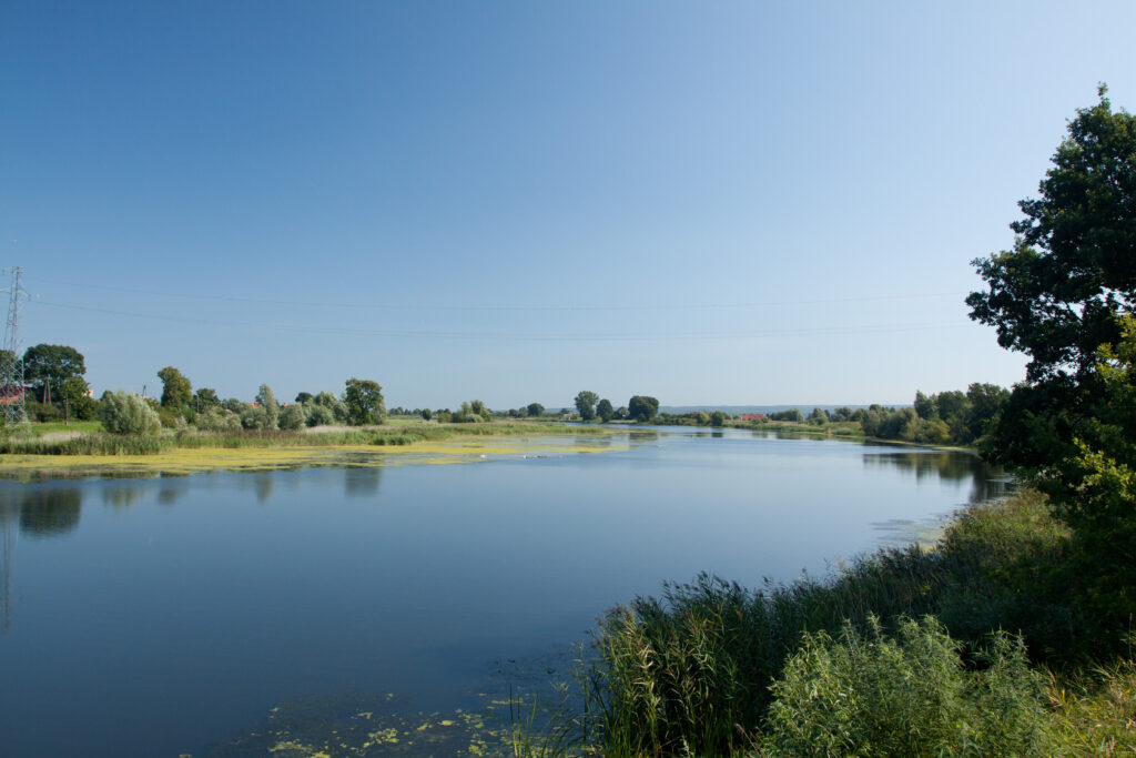
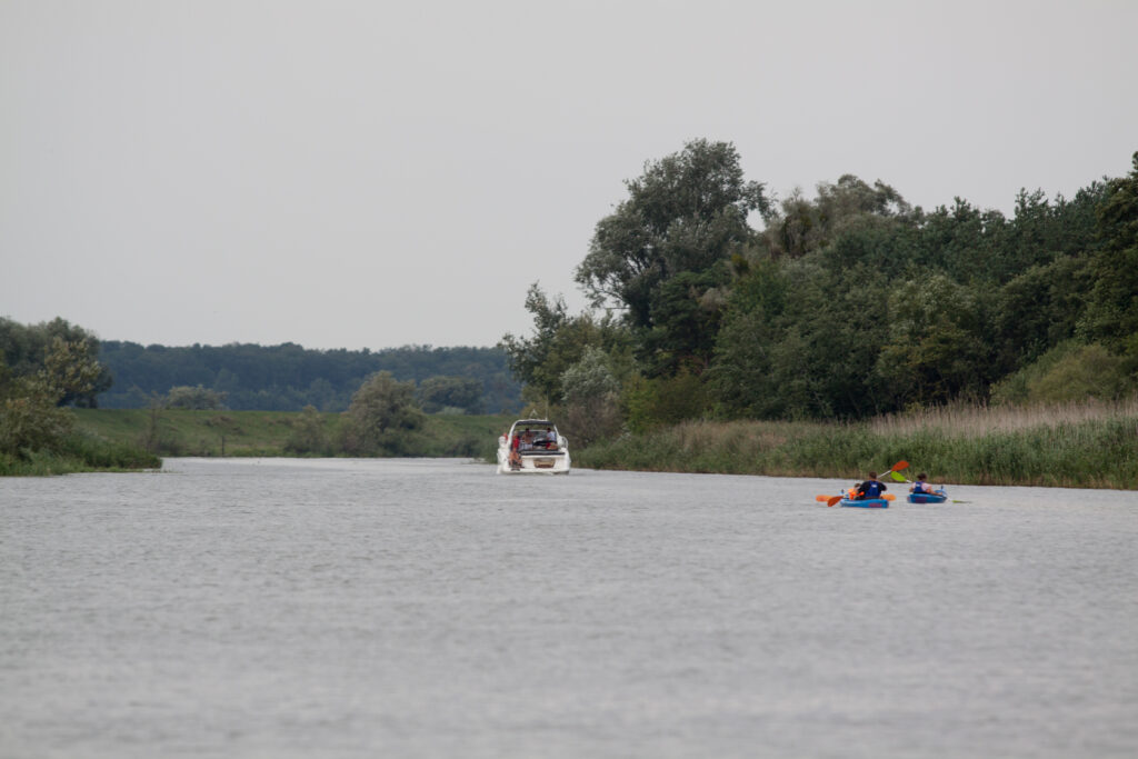
Nogat is listed as a navigable water trail and can be separated into two sections. The first one, from the Biała Góra lock to the Rakowiec barrage, and the second from Rakowiec to the mouth at Zalew Wiślany. The river includes a slow current, is wide, channelized, and navigable across both sections.
The width of Nogat ranges between 80 and 200 m whereas, the width of the navigable kayaking trail separated with the use of buoys is at circa 30 m. Travelling with the current we leave the green buoys on the left and the red on the right side of our kayak. White plates including kilometer markings appear rather rarely on the shores